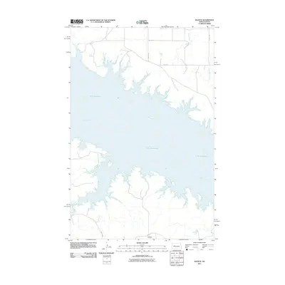
2011 Map of Raub SE
USGS Topo · Published 2011About this map
Lake Sakakawea dominates this landscape, where the waters of the impounded Missouri River fill the winding valleys of the northern plains. This 2011 survey captures the complex, jagged shoreline along the southern and northern reaches of the reservoir, highlighting the interaction between the modern water level and the underlying topography. On the southern shore, Red Butte Cemetery remains a significant local landmark, situated near BIA Route 22. The map also details the drainage patterns of northern tributaries like Sixmile Creek and Buffalo Rock Coulee, which cut through the high ground above the lake. A sparse network of rural roads, including 14th St NW and 89th Ave NW, provides the primary access to the peninsulas and bluffs overlooking the water.
Find a feature on this map
13 named features on this map. Tap any name to fly to it.
Don’t see what you’re looking for? This feature index may not catch every label — zoom into the map to look around manually.
Map Details
Editions of this 2011 Raub SE Map
This is the sole edition of this map. No revisions or reprints were ever made.
Other maps of this area

1953 · Watford City
USGS Topo · 1:250,000

1954 · McClusky
USGS Topo · 1:250,000

1956 · Blackwater Lake NW
USGS Topo · 1:24,000

1957 · Watford City
USGS Topo · 1:250,000

1958 · McClusky
USGS Topo · 1:250,000

1967 · Watford City
USGS Topo · 1:250,000

1967 · Raub SE
USGS Topo · 1:24,000

1967 · Raub NW
USGS Topo · 1:24,000

1967 · Raub
USGS Topo · 1:24,000

1967 · Twin Buttes
USGS Topo · 1:24,000