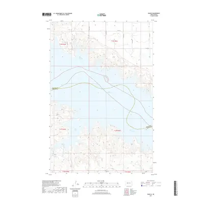
2017 Map of Raub SE
USGS Topo · Published 2017About this map
The Missouri River defines the central topography of this region, winding through the expansive waters of Lake Sakakawea. This landscape is marked by the irregular, flooded indentations of the shoreline, including Good Bear Bay to the north and Red Butte Bay to the south. The terrain is deeply carved by drainage features such as Sixmile Cr and the Buffalo Rock Coulee, which flow toward the reservoir. Cultural markers are concentrated in the southern portion of the sheet, where Red Butte Cem sits near the junction of local routes like BIA Rd 22. The map also illustrates the political geography of the Missouri riverbed, tracing the meandering boundary between McLean Co and Mercer Co as it follows the original river channel beneath the modern lake surface.
Find a feature on this map
18 named features on this map. Tap any name to fly to it.
Don’t see what you’re looking for? This feature index may not catch every label — zoom into the map to look around manually.
Map Details
Editions of this 2017 Raub SE Map
This is the sole edition of this map. No revisions or reprints were ever made.
Other maps of this area

1953 · Watford City
USGS Topo · 1:250,000

1954 · McClusky
USGS Topo · 1:250,000

1956 · Blackwater Lake NW
USGS Topo · 1:24,000

1957 · Watford City
USGS Topo · 1:250,000

1958 · McClusky
USGS Topo · 1:250,000

1967 · Watford City
USGS Topo · 1:250,000

1967 · Raub SE
USGS Topo · 1:24,000

1967 · Raub NW
USGS Topo · 1:24,000

1967 · Raub
USGS Topo · 1:24,000

1967 · Twin Buttes
USGS Topo · 1:24,000