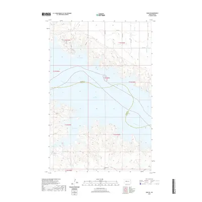
2020 Map of Raub SE
USGS Topo · Published 2020About this map
Lake Sakakawea dominates this landscape along the border of McLean and Mercer Counties, illustrating the modern geography of the Missouri River valley. The map details the jagged northern and southern shorelines of the reservoir, including the deep inlets of Good Bear Bay and Red Butte Bay. These waters cover historic bottomlands, leaving only the higher plateaus and coulees, such as Buffalo Rock Coulee and the drainage of Sixmile Cr, as visible landmarks of the original terrain. Evidence of early settlement remains on the higher ground south of the lake, specifically the Congregational Cem located near Bia Rd 22. The presence of Bureau of Indian Affairs routes like Bia Rd 20 reflects the area's ongoing importance within the regional transportation network and its connection to surrounding communities.
Find a feature on this map
19 named features on this map. Tap any name to fly to it.
Don’t see what you’re looking for? This feature index may not catch every label — zoom into the map to look around manually.
Map Details
Editions of this 2020 Raub SE Map
This is the sole edition of this map. No revisions or reprints were ever made.
Other maps of this area

1953 · Watford City
USGS Topo · 1:250,000

1954 · McClusky
USGS Topo · 1:250,000

1956 · Blackwater Lake NW
USGS Topo · 1:24,000

1957 · Watford City
USGS Topo · 1:250,000

1958 · McClusky
USGS Topo · 1:250,000

1967 · Watford City
USGS Topo · 1:250,000

1967 · Raub SE
USGS Topo · 1:24,000

1967 · Raub NW
USGS Topo · 1:24,000

1967 · Raub
USGS Topo · 1:24,000

1967 · Twin Buttes
USGS Topo · 1:24,000