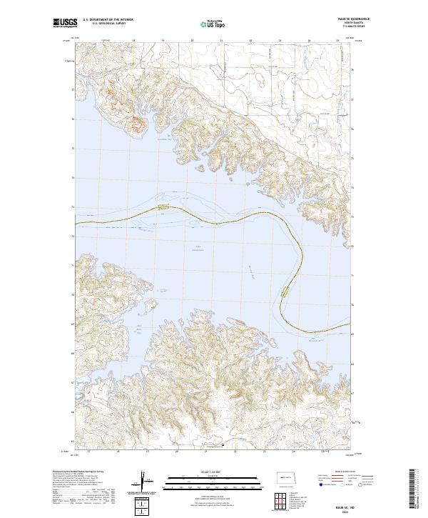
2024 Map of Raub SE
USGS Topo · Published 2024About this map
Lake Sakakawea dominates the landscape in this region where the Missouri River has been transformed into a massive reservoir system. The intricate, finger-like shorelines of Good Bear Bay and Red Butte Bay illustrate how the rising waters flooded the local coulees and drainages. This high-resolution survey captures the modern geography of the area along the boundary of McLean and Mercer counties. Notable local landmarks include the Congregational Cem near the southern edge of the map, and the rugged drainage of Buffalo Rock Coulee to the northeast. The transport network consists largely of section-line roads such as 70th Ave NW and BIA Rd 22, reflecting the organized land division of the Missouri River plateau.
Find a feature on this map
21 named features on this map. Tap any name to fly to it.
Don’t see what you’re looking for? This feature index may not catch every label — zoom into the map to look around manually.
Map Details
Editions of this 2024 Raub SE Map
This is the sole edition of this map. No revisions or reprints were ever made.
Other maps of this area

1953 · Watford City
USGS Topo · 1:250,000

1954 · McClusky
USGS Topo · 1:250,000

1956 · Blackwater Lake NW
USGS Topo · 1:24,000

1957 · Watford City
USGS Topo · 1:250,000

1958 · McClusky
USGS Topo · 1:250,000

1967 · Watford City
USGS Topo · 1:250,000

1967 · Raub SE
USGS Topo · 1:24,000

1967 · Raub NW
USGS Topo · 1:24,000

1967 · Raub
USGS Topo · 1:24,000

1967 · Twin Buttes
USGS Topo · 1:24,000