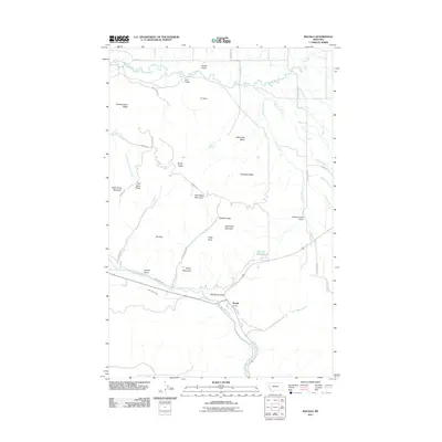
2011 Map of Ravalli
USGS Topo · Published 2011About this map
Ravalli sits at the confluence of the Jocko River and Copper Creek, serving as a focal point in a landscape defined by significant water management and rugged topography. The Lower Jocko Canal traces the southern slopes, while the northern reaches are dominated by Mission Creek and the unique geological formation of the Ravalli Potholes. Transportation history is etched into the terrain through the presence of the Old Freight Rd, which once connected the valley's disparate settlements and basins.
Find a feature on this map
44 named features on this map. Tap any name to fly to it.
Don’t see what you’re looking for? This feature index may not catch every label — zoom into the map to look around manually.
Map Details
Editions of this 2011 Ravalli Map
This is the sole edition of this map. No revisions or reprints were ever made.
Other maps of this area

1956 · Wallace
USGS Topo · 1:250,000

1959 · Alberton
USGS Topo · 1:62,500

1959 · Arlee
USGS Topo · 1:62,500

1960 · Wallace
USGS Topo · 1:250,000

1964 · Dixon
USGS Topo · 1:24,000

1964 · Fort Connah
USGS Topo · 1:24,000

1964 · Saint Ignatius
USGS Topo · 1:24,000

1964 · Ravalli
USGS Topo · 1:24,000

1965 · Sloan
USGS Topo · 1:24,000
1965 · Charlo
USGS Topo · 1:24,000