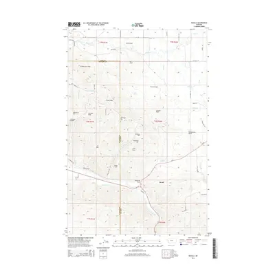
2014 Map of Ravalli
USGS Topo · Published 2014About this map
The Jocko River and its confluence with Copper Cr form a central hydrological corridor through this portion of western Montana, where the border between Lake County and Sanders County cuts through a landscape of high ridges and deep basins. The settlement of Ravalli sits at the junction of Us-93 and MT-200, serving as a gateway to the complex terrain of the National Bison Range area. Water management is evident through the Lower Jocko Canal, while the historical movement of people is marked by the Bitterroot Trail and the Old Freight Rd. Notable summits and passes, such as Red Sleep Mtn, Getaway Pass, and Telephone Mtn, define the topography, alongside unique geological features like the Ravalli Potholes and the sheltered Alexander Basin.
Find a feature on this map
64 named features on this map. Tap any name to fly to it.
Don’t see what you’re looking for? This feature index may not catch every label — zoom into the map to look around manually.
Map Details
Editions of this 2014 Ravalli Map
This is the sole edition of this map. No revisions or reprints were ever made.
Other maps of this area

1956 · Wallace
USGS Topo · 1:250,000

1959 · Alberton
USGS Topo · 1:62,500

1959 · Arlee
USGS Topo · 1:62,500

1960 · Wallace
USGS Topo · 1:250,000

1964 · Dixon
USGS Topo · 1:24,000

1964 · Fort Connah
USGS Topo · 1:24,000

1964 · Saint Ignatius
USGS Topo · 1:24,000

1964 · Ravalli
USGS Topo · 1:24,000

1965 · Sloan
USGS Topo · 1:24,000
1965 · Charlo
USGS Topo · 1:24,000