2024 Map of Ravalli
USGS Topo · Published 2024About this map
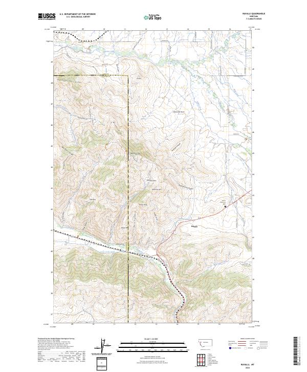
The National Bison Range dominates this landscape, preserving a dramatic section of the Bitterroot Valley where the Jocko River and Mission Creek converge. The settlement of Ravalli sits at a critical geographic junction, flanked by the Ravalli Potholes and the engineering of the Lower Jocko Canal. The terrain is defined by prominent elevations such as Red Sleep Mtn, Telephone Mtn, and Windy Ridge, which provide a natural backdrop to the historical transit corridor of the Old Freight Rd. Local history is anchored by landmarks like the Krantz Memorial Cem and diverse water features including Post Creek and Pistol Creek. The map details the complex intersection of Lake and Sanders counties, illustrating the transition from managed wildlife habitat to the agricultural and irrigation networks that support the valley.
Find a feature on this map
58 named features on this map. Tap any name to fly to it.
Don’t see what you’re looking for? This feature index may not catch every label — zoom into the map to look around manually.
Map Details
Editions of this 2024 Ravalli Map
This is the sole edition of this map. No revisions or reprints were ever made.