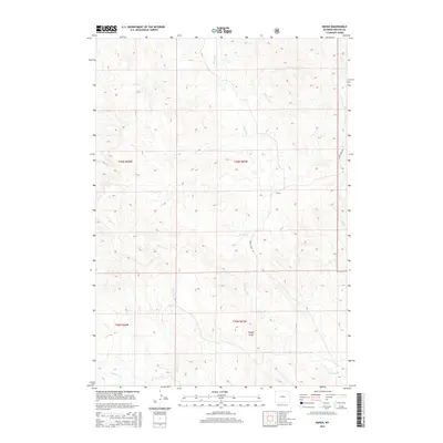
2015 Map of Raven
USGS Topo · Published 2015About this map
Raven is the central named point of interest in this section of Wyoming, situated within a landscape defined by an intricate network of drainage systems. The terrain is notably dissected by watercourses such as Raven Cr and Lone Tree Cr, which contribute to the local topography of areas like Rough Draw. These creek beds and draws offer a window into the land's hydrology and the natural pathways that likely influenced early navigation and ranching boundaries in the county.
Find a feature on this map
11 named features on this map. Tap any name to fly to it.
Don’t see what you’re looking for? This feature index may not catch every label — zoom into the map to look around manually.
Map Details
Editions of this 2015 Raven Map
This is the sole edition of this map. No revisions or reprints were ever made.
Other maps of this area

1918 · Moorcroft
USGS Topo · 1:125,000

1954 · Gillette
USGS Topo · 1:250,000

1955 · Newcastle
USGS Topo · 1:250,000

1955 · Gillette
USGS Topo · 1:250,000

1958 · Gillette
USGS Topo · 1:250,000

1958 · Newcastle
USGS Topo · 1:250,000

1962 · Gillette
USGS Topo · 1:250,000
1971 · Whitetail Creek SE
USGS Topo · 1:24,000
1971 · Jim Creek
USGS Topo · 1:24,000
1971 · Buck Creek
USGS Topo · 1:24,000