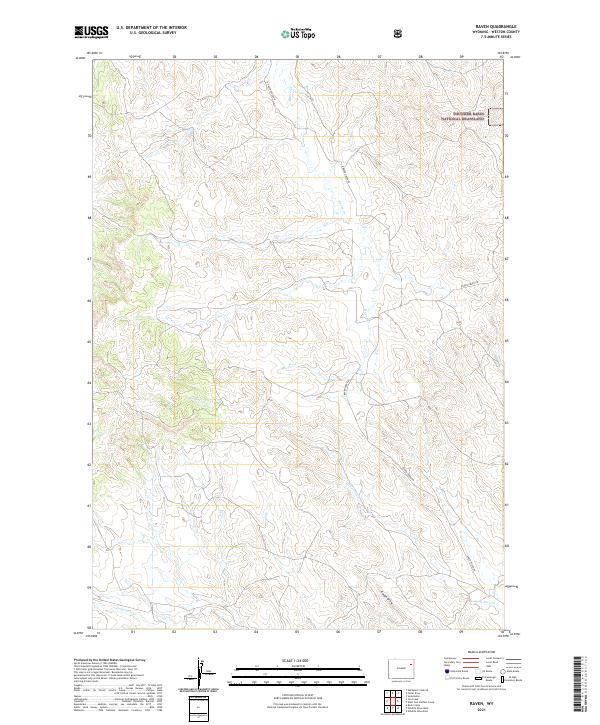
2021 Map of Raven
USGS Topo · Published 2021About this map
Thunder Basin National Grassland dominates the northeastern corner of this Weston County terrain, where the high plains landscape is defined by a dendritic network of ephemeral waterways. The drainage pattern here is anchored by Raven Cr and Lone Tree Cr, which snake through the township boundaries of T46N and T45N. This survey provides a contemporary record of land management and access in a sparsely populated region of Wyoming, where human presence is largely marked by the linear paths of N Raven Creek Rd and Raven Creek Rd. In the southern reaches of the quadrangle, Sage Cr and Lodgepole Cr traverse the open ground, while the distinct incision of Rough Draw provides one of the few named topographical relief features in this expansive public land system.
Find a feature on this map
12 named features on this map. Tap any name to fly to it.
Don’t see what you’re looking for? This feature index may not catch every label — zoom into the map to look around manually.
Map Details
Editions of this 2021 Raven Map
This is the sole edition of this map. No revisions or reprints were ever made.
Other maps of this area

1918 · Moorcroft
USGS Topo · 1:125,000

1954 · Gillette
USGS Topo · 1:250,000

1955 · Newcastle
USGS Topo · 1:250,000

1955 · Gillette
USGS Topo · 1:250,000

1958 · Gillette
USGS Topo · 1:250,000

1958 · Newcastle
USGS Topo · 1:250,000

1962 · Gillette
USGS Topo · 1:250,000
1971 · Whitetail Creek SE
USGS Topo · 1:24,000
1971 · Jim Creek
USGS Topo · 1:24,000
1971 · Buck Creek
USGS Topo · 1:24,000