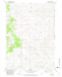
1982 Map of Raven
USGS Topo · Published 1982About this map
The Lone Tree Creek Oil Field anchors the southern portion of this Weston County landscape, highlighting the energy development occurring in the region during the 1970s and early 1980s. A network of numerous Oil Wells and dispersed Drill Holes stretches across the drainage basins of Sage Creek and Lodgepole Creek, illustrating the industrial footprint on this high plains terrain. The mapping, based on 1974 aerial photography, shows a landscape defined more by resource extraction and hydrology than by permanent settlements.
Find a feature on this map
14 named features on this map. Tap any name to fly to it.
Don’t see what you’re looking for? This feature index may not catch every label — zoom into the map to look around manually.
Map Details
Editions of this 1982 Raven Map
This is the sole edition of this map. No revisions or reprints were ever made.
Other maps of this area

1918 · Moorcroft
USGS Topo · 1:125,000

1954 · Gillette
USGS Topo · 1:250,000

1955 · Newcastle
USGS Topo · 1:250,000

1955 · Gillette
USGS Topo · 1:250,000

1958 · Gillette
USGS Topo · 1:250,000

1958 · Newcastle
USGS Topo · 1:250,000

1962 · Gillette
USGS Topo · 1:250,000
1971 · Whitetail Creek SE
USGS Topo · 1:24,000
1971 · Jim Creek
USGS Topo · 1:24,000
1971 · Buck Creek
USGS Topo · 1:24,000