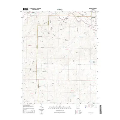
2014 Map of Ravenden
USGS Topo · Published 2014About this map
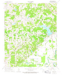
The Spring River carves a winding path across the northern border of this Arkansas landscape, defining the topography of the Sharp and Lawrence County line. The settlement of Ravenden sits at the northeast corner, serving as a hub for a network of rural roads that stretch into the hills. The terrain is marked by numerous named ridges and hollows, including Goat Shed Mtn, Bald Knob, and the deep Buzzard Roost Canyon. Genealogists will find several burial sites preserved on the landscape, such as Opposition Cem, Dall Cem, and Coffman Cem. In the southern reaches, the Cooper Cr Site Two Reservoir indicates mid-century water management efforts, while landmarks like Watts Bluff and Cave Hill reflect the varying elevations. This documentation of the area around Williford and Ravenden shows the distribution of remote farmsteads and the persistence of traditional place names like Wild Hog Hollow and Captain Sanders Hollow.
Find a feature on this map
101 named features on this map. Tap any name to fly to it.
Don’t see what you’re looking for? This feature index may not catch every label — zoom into the map to look around manually.
Map Details
Editions of this 2014 Ravenden Map
This is the sole edition of this map. No revisions or reprints were ever made.
Other maps of this area

1934 · Powhatan
USGS Topo · 1:62,500

1935 · Powhatan
USGS Topo · 1:62,500

1957 · Poplar Bluff
USGS Topo · 1:250,000

1959 · Poplar Bluff
USGS Topo · 1:250,000

1960 · Poplar Bluff
USGS Topo · 1:250,000
1965 · Poughkeepsie
USGS Topo · 1:24,000
1965 · Smithville
USGS Topo · 1:24,000

1966 · Ravenden Springs
USGS Topo · 1:24,000
1966 · Imboden
USGS Topo · 1:24,000
1966 · Eaton
USGS Topo · 1:24,000