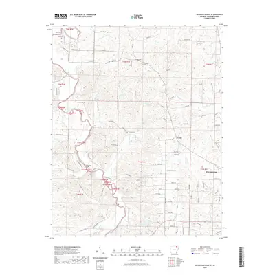
2020 Map of Ravenden Springs SE
USGS Topo · Published 2020About this map
The Eleven Point River carves a winding path through this corner of Randolph County, defining the local geography around the settlement of Lorine. This 2020 survey documents a landscape where agricultural heritage and rural life intersect with the river's drainage network, including Thompson Creek and Allred Creek. The area is notably dense with small family and community burial grounds, such as Shiloh Cem and Gravesville Cem, which offer significant value for genealogists tracing regional lineages. Significant landmarks like the Black Ferry Bridge facilitate movement across the river, while natural features like Blue Basin Lake and Coldwater Spring provide clear indicators of the local water table. To the east, the map captures the western outskirts of Pocahontas, showing the transition from the town’s grid to the more varied, winding road systems that follow the ridgelines and creek beds toward Cooley Hill.
Find a feature on this map
107 named features on this map. Tap any name to fly to it.
Don’t see what you’re looking for? This feature index may not catch every label — zoom into the map to look around manually.
Map Details
Editions of this 2020 Ravenden Springs SE Map
This is the sole edition of this map. No revisions or reprints were ever made.
Other maps of this area

1932 · Walnut Ridge
USGS Topo · 1:62,500

1934 · Powhatan
USGS Topo · 1:62,500

1935 · Powhatan
USGS Topo · 1:62,500

1935 · Reyno
USGS Topo · 1:62,500

1935 · Walnut Ridge
USGS Topo · 1:62,500

1957 · Poplar Bluff
USGS Topo · 1:250,000

1959 · Poplar Bluff
USGS Topo · 1:250,000

1960 · Poplar Bluff
USGS Topo · 1:250,000
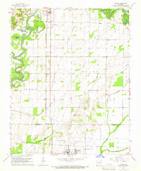
1965 · Manson
USGS Topo · 1:24,000

1966 · Ravenden Springs
USGS Topo · 1:24,000