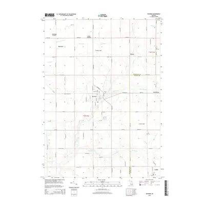
2014 Map of Ravenna
USGS Topo · Published 2014About this map
Ravenna serves as the central hub of this West Michigan landscape, situated at the intersection of a complex drainage network including Crockery Cr and its various branches. The area is defined by its agricultural layout, organized by the township and range lines of t9n r14w and t10n r14w. This 2014 survey documents the enduring settlement patterns of small communities like Harrisburg, Slocum, and Conklin, which are connected by a grid of county roads. Genealogists will find significant value in the distribution of local burial sites, including the Saint Catherine's Cem and the Moorland Cem further north. The terrain is marked by engineered water management systems such as the Porter Drain and Eastland Drain, which support the low-lying farmlands between the Muskegon Co and Ottawa Co border.
Find a feature on this map
77 named features on this map. Tap any name to fly to it.
Don’t see what you’re looking for? This feature index may not catch every label — zoom into the map to look around manually.
Map Details
Editions of this 2014 Ravenna Map
This is the sole edition of this map. No revisions or reprints were ever made.
Other maps of this area

1930 · Muskegon
USGS Topo · 1:62,500

1936 · Muskegon
USGS Topo · 1:62,500

1945 · Ravenna
USGS Topo · 1:62,500

1954 · Milwaukee
USGS Topo · 1:250,000

1954 · Midland
USGS Topo · 1:250,000

1958 · Midland
USGS Topo · 1:250,000

1958 · Milwaukee
USGS Topo · 1:250,000

1958 · Twin Lake
USGS Topo · 1:62,500

1958 · Fremont
USGS Topo · 1:62,500

1959 · Midland
USGS Topo · 1:250,000