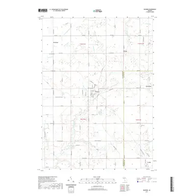
2019 Map of Ravenna
USGS Topo · Published 2019About this map
Ravenna serves as a central hub on this landscape where Muskegon and Ottawa counties meet. The village is surrounded by a network of drainage infrastructure and natural waterways, including Crockery Creek and its many tributaries such as N Br Crockery Cr and Eastland Drain. For genealogists and family historians, the sheet provides precise locations for several local burial grounds, including Moorland Cem, Ravenna Cem, and the Saint Catherine's Cem complex near the town center. The presence of smaller outlying settlements like Slocum, Harrisburg, and Moorland indicates the historic agricultural and residential pattern of the region. Transportation and recreation are represented by the Musketawa State Trail, which cuts across the landscape on a clear diagonal, likely following a former rail corridor. The map further documents numerous named rural roads like S Ravenna Rd and Apple Ave, which organize the farmsteads and homes across this western Michigan terrain.
Find a feature on this map
76 named features on this map. Tap any name to fly to it.
Don’t see what you’re looking for? This feature index may not catch every label — zoom into the map to look around manually.
Map Details
Editions of this 2019 Ravenna Map
This is the sole edition of this map. No revisions or reprints were ever made.
Other maps of this area

1930 · Muskegon
USGS Topo · 1:62,500

1936 · Muskegon
USGS Topo · 1:62,500

1945 · Ravenna
USGS Topo · 1:62,500

1954 · Milwaukee
USGS Topo · 1:250,000

1954 · Midland
USGS Topo · 1:250,000

1958 · Midland
USGS Topo · 1:250,000

1958 · Milwaukee
USGS Topo · 1:250,000

1958 · Twin Lake
USGS Topo · 1:62,500

1958 · Fremont
USGS Topo · 1:62,500

1959 · Midland
USGS Topo · 1:250,000