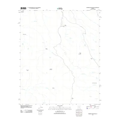
2011 Map of Rawhide Mountain
USGS Topo · Published 2011About this map
Rawhide Mountain and Copper Reef Mountain dominate this corner of Pinal County, where the desert landscape is defined by remote ranching outposts and scattered water sources. Isolated structures like the Sanders Rangeline Cabin and U B Rangeline Cabin signify the long-standing range management and livestock history of the region. The map reveals a network of canyons including Janis Canyon and Buck Canyon, which channel seasonal runoff toward Garden Creek and Deer Creek.
Find a feature on this map
34 named features on this map. Tap any name to fly to it.
Don’t see what you’re looking for? This feature index may not catch every label — zoom into the map to look around manually.
Map Details
Editions of this 2011 Rawhide Mountain Map
This is the sole edition of this map. No revisions or reprints were ever made.
Other maps of this area

1911 · Winkelman
USGS Topo · 1:125,000

1913 · Winkelman
USGS Topo · 1:125,000

1915 · Christmas
USGS Topo · 1:62,500

1917 · Christmas
USGS Topo · 1:62,500

1938 · Klondyke
USGS Topo · 1:48,000

1943 · Klondyke
USGS Topo · 1:62,500

1949 · Holy Joe Peak
USGS Topo · 1:62,500

1949 · Brandenburg Mtn
USGS Topo · 1:24,000
1950 · Brandenburg Mtn
USGS Topo · 1:24,000

1954 · Mesa
USGS Topo · 1:250,000