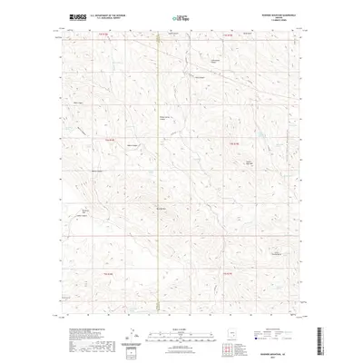
2021 Map of Rawhide Mountain
USGS Topo · Published 2021About this map
Rawhide Mtn anchors this arid landscape in eastern Pinal Co, where the terrain transitions into the western reaches of the Santa Teresa Mountains. This 2021 survey illustrates a region defined by complex canyon systems and seasonal water sources essential for cattle and wildlife, such as Willow Spring, Ash Spring, and Janis Spring. The map documents a network of county roads, including Co RD 300 and Co RD 303, which navigate through deep cuts like Janis Canyon and Cottonwood Canyon. To the south, the topography rises toward Copper Reef Mtn and Little Stanley Butte, with the drainage of Deer Cr and Garden Cr shaping the lower elevations. The placement of named points like Beargrass Flat and Red Rooster Mtn reflects a history of local land use and geographic identification in this high-desert environment.
Find a feature on this map
45 named features on this map. Tap any name to fly to it.
Don’t see what you’re looking for? This feature index may not catch every label — zoom into the map to look around manually.
Map Details
Editions of this 2021 Rawhide Mountain Map
This is the sole edition of this map. No revisions or reprints were ever made.
Other maps of this area

1911 · Winkelman
USGS Topo · 1:125,000

1913 · Winkelman
USGS Topo · 1:125,000

1915 · Christmas
USGS Topo · 1:62,500

1917 · Christmas
USGS Topo · 1:62,500

1938 · Klondyke
USGS Topo · 1:48,000

1943 · Klondyke
USGS Topo · 1:62,500

1949 · Holy Joe Peak
USGS Topo · 1:62,500

1949 · Brandenburg Mtn
USGS Topo · 1:24,000
1950 · Brandenburg Mtn
USGS Topo · 1:24,000

1954 · Mesa
USGS Topo · 1:250,000