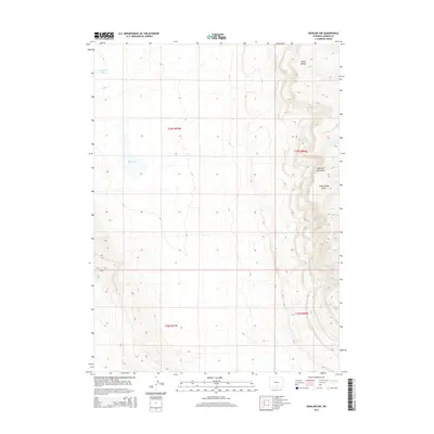
2015 Map of Rawlins NW
USGS Topo · Published 2015About this map
Haystack Mountains dominate the eastern landscape of this high-desert region in southern Wyoming. The terrain is defined by dramatic elevation changes, moving from the open flats of Township 23 North, Range 87 West toward the ridgelines that shelter Blind Canyon and the winding course of Little Shoe Cr. Water sources are sparse but central to the geography here, represented by the ephemeral Separation Lake and the aptly named Dry Lake in the northwest. This topographic study reveals a land shaped by drainage patterns such as Lost Springs Draw, providing a clear view of the natural corridors and livestock-grazing boundaries established by the Public Land Survey System during this era of 21st-century land management.
Find a feature on this map
10 named features on this map. Tap any name to fly to it.
Don’t see what you’re looking for? This feature index may not catch every label — zoom into the map to look around manually.
Map Details
Editions of this 2015 Rawlins NW Map
This is the sole edition of this map. No revisions or reprints were ever made.
Other maps of this area

1953 · Wild Horse Mountain
USGS Topo · 1:24,000

1953 · Sinclair
USGS Topo · 1:24,000

1953 · Riddle Cut
USGS Topo · 1:24,000

1953 · Rawlins
USGS Topo · 1:24,000

1953 · Lone Haystack Mountain
USGS Topo · 1:24,000

1953 · Rawlins NW
USGS Topo · 1:24,000

1954 · Rawlins
USGS Topo · 1:250,000

1955 · Casper
USGS Topo · 1:250,000

1956 · Rawlins Peak
USGS Topo · 1:62,500

1958 · Rawlins
USGS Topo · 1:250,000