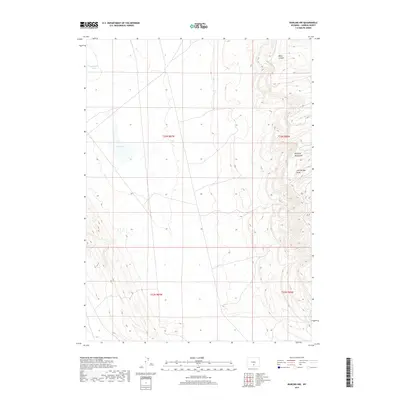
2017 Map of Rawlins NW
USGS Topo · Published 2017About this map
Haystack Mountains rise sharply in the eastern portion of this Carbon County quadrant, providing a stark topographical contrast to the basin floors to the west. The landscape is defined by its arid drainage patterns, characterized by features such as Lost Springs Draw and the narrow corridor of Blind Canyon. Water in this high-desert environment is primarily captured in depressions, including the prominent Separation Lake in the northwest and the ephemeral Dry Lake further south. The map reflects a modern landscape of vast public land divisions, with the t23n r87w and t23n r86w townships delineating the high plains and ridge lines that define this section of the Wyoming interior north of the regional transport corridors.
Find a feature on this map
10 named features on this map. Tap any name to fly to it.
Don’t see what you’re looking for? This feature index may not catch every label — zoom into the map to look around manually.
Map Details
Editions of this 2017 Rawlins NW Map
This is the sole edition of this map. No revisions or reprints were ever made.
Other maps of this area

1953 · Wild Horse Mountain
USGS Topo · 1:24,000

1953 · Sinclair
USGS Topo · 1:24,000

1953 · Riddle Cut
USGS Topo · 1:24,000

1953 · Rawlins
USGS Topo · 1:24,000

1953 · Lone Haystack Mountain
USGS Topo · 1:24,000

1953 · Rawlins NW
USGS Topo · 1:24,000

1954 · Rawlins
USGS Topo · 1:250,000

1955 · Casper
USGS Topo · 1:250,000

1956 · Rawlins Peak
USGS Topo · 1:62,500

1958 · Rawlins
USGS Topo · 1:250,000