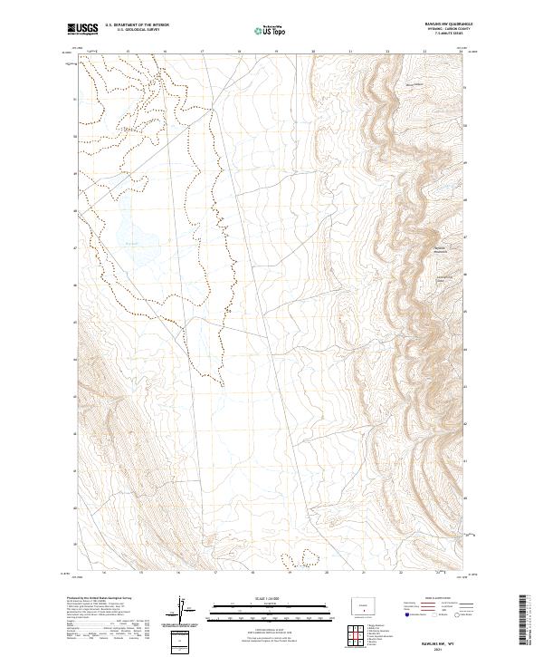
2021 Map of Rawlins NW
USGS Topo · Published 2021About this map
The Haystack Mountains define the eastern edge of this high-altitude landscape in Carbon County, where elevation changes are sharp and the terrain is carved by seasonal drainage patterns. The presence of Dry Lake in the western reaches suggests a landscape that fluctuates significantly with the seasons, characteristic of the arid high plains of Wyoming. This 2021 update by the U.S. Geological Survey tracks the remote terrain between t23n r87w and t23n r86w, an area primarily defined by natural landforms rather than human settlement.
Find a feature on this map
9 named features on this map. Tap any name to fly to it.
Don’t see what you’re looking for? This feature index may not catch every label — zoom into the map to look around manually.
Map Details
Editions of this 2021 Rawlins NW Map
This is the sole edition of this map. No revisions or reprints were ever made.
Other maps of this area

1953 · Wild Horse Mountain
USGS Topo · 1:24,000

1953 · Sinclair
USGS Topo · 1:24,000

1953 · Riddle Cut
USGS Topo · 1:24,000

1953 · Rawlins
USGS Topo · 1:24,000

1953 · Lone Haystack Mountain
USGS Topo · 1:24,000

1953 · Rawlins NW
USGS Topo · 1:24,000

1954 · Rawlins
USGS Topo · 1:250,000

1955 · Casper
USGS Topo · 1:250,000

1956 · Rawlins Peak
USGS Topo · 1:62,500

1958 · Rawlins
USGS Topo · 1:250,000