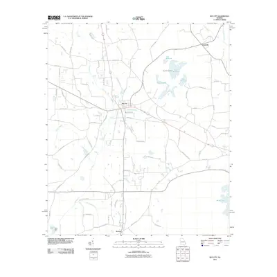
2011 Map of Ray City
USGS Topo · Published 2011About this map
Ray City serves as the central hub of this South Georgia landscape, where a network of county roads and historic drainage patterns define the settlement of Berrien County. The topography is dominated by an intricate system of creeks and ponds, notably the expansive Rays Millpond with its associated Rays Mill Pond Dam to the northeast. This water-rich environment is further characterized by Beaverdam Creek flowing near the heart of town and the large Banks Lake bordering the southeastern edge.
Find a feature on this map
65 named features on this map. Tap any name to fly to it.
Don’t see what you’re looking for? This feature index may not catch every label — zoom into the map to look around manually.
Map Details
Editions of this 2011 Ray City Map
This is the sole edition of this map. No revisions or reprints were ever made.
Other maps of this area

1953 · Waycross
USGS Topo · 1:250,000

1954 · Valdosta
USGS Topo · 1:250,000

1958 · Valdosta
USGS Topo · 1:250,000

1958 · Waycross
USGS Topo · 1:250,000

1959 · Valdosta
USGS Topo · 1:250,000

1961 · Hahira East
USGS Topo · 1:24,000

1968 · Naylor
USGS Topo · 1:24,000

1968 · Lakeland
USGS Topo · 1:24,000
1971 · Bemiss
USGS Topo · 1:24,000

1973 · New Lois
USGS Topo · 1:24,000