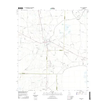
2014 Map of Ray City
USGS Topo · Published 2014About this map
Ray City serves as the central hub of this South Georgia landscape, where the confluence of several small waterways defines the local geography. The town is situated near the headwaters of Beaverdam Cr and Batterbee Br, with the Ray City Cem located just south of the main settlement. The area is characterized by a low-lying network of creeks and ponds, most notably the expansive Rays Millpond to the northeast, which straddles the boundary between Berrien and Lanier Counties. Further south, the settlement of Barretts sits near the crossing of Beatty-Mill Cr. This 2014 survey documents the modern road network, including Ga-37 and Ga-122, which connect these rural communities across a terrain of agricultural fields and timberland, reflecting the enduring rural character of this Georgia coastal plain region.
Find a feature on this map
118 named features on this map. Tap any name to fly to it.
Don’t see what you’re looking for? This feature index may not catch every label — zoom into the map to look around manually.
Map Details
Editions of this 2014 Ray City Map
This is the sole edition of this map. No revisions or reprints were ever made.
Other maps of this area

1953 · Waycross
USGS Topo · 1:250,000

1954 · Valdosta
USGS Topo · 1:250,000

1958 · Valdosta
USGS Topo · 1:250,000

1958 · Waycross
USGS Topo · 1:250,000

1959 · Valdosta
USGS Topo · 1:250,000

1961 · Hahira East
USGS Topo · 1:24,000

1968 · Naylor
USGS Topo · 1:24,000

1968 · Lakeland
USGS Topo · 1:24,000
1971 · Bemiss
USGS Topo · 1:24,000

1973 · New Lois
USGS Topo · 1:24,000