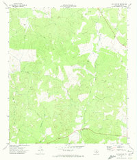
1971 Map of Ray Lake SW
USGS Topo · Published 1974About this map
The West Nueces River carves a deep path through this portion of Edwards County, where the landscape is defined by its drainage network and scattered water sources. This 1971 field-checked survey reveals a sparsely developed ranching or hunting territory characterized by named natural features like Geronimo Creek and the subterranean landmark of Davis Cave.
Find a feature on this map
9 named features on this map. Tap any name to fly to it.
Don’t see what you’re looking for? This feature index may not catch every label — zoom into the map to look around manually.
Map Details
Editions of this 1971 Ray Lake SW Map
2 editions found
Other maps of this area

1893 · Rock Springs
USGS Topo · 1:125,000

1893 · Nueces
USGS Topo · 1:125,000

1896 · Nueces
USGS Topo · 1:125,000

1943 · Carta Valley
USGS Topo · 1:62,500

1944 · Indian Creek
USGS Topo · 1:62,500

1954 · Sonora
USGS Topo · 1:250,000

1958 · Sonora
USGS Topo · 1:250,000

1958 · Del Rio
USGS Topo · 1:250,000

1964 · Del Rio
USGS Topo · 1:250,000

1970 · Ray Lake NW
USGS Topo · 1:24,000