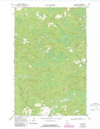
1969 Map of Ray SW
USGS Topo · Published 1987About this map
The Duluth Winnipeg and Pacific railroad cuts through the northeastern corner of this Koochiching County landscape, a region defined by extensive wetlands and meandering watercourses. The Rat Root River dominates the central and eastern portions of the map, twisting through a network of marshes and low-lying woodland. Southward, Beaver Brook winds across the terrain, illustrating the complex drainage patterns of the Minnesota north woods. A prominent Winter Trail provides a historical look at seasonal navigation through these damp lowlands, where standard passage was restricted by the soft earth of the peatlands. While largely devoid of permanent settlements, the area shows evidence of local infrastructure and materials sourcing through scattered Gravel Pits, often situated near the forest trails and the railroad corridor.
Find a feature on this map
6 named features on this map. Tap any name to fly to it.
Don’t see what you’re looking for? This feature index may not catch every label — zoom into the map to look around manually.
Map Details
Editions of this 1969 Ray SW Map
2 editions found
Other maps of this area

1954 · International Falls
USGS Topo · 1:250,000

1957 · International Falls
USGS Topo · 1:250,000

1958 · International Falls
USGS Topo · 1:250,000

1969 · Ray SE
USGS Topo · 1:24,000

1969 · Ericsburg
USGS Topo · 1:24,000

1969 · Ericsburg SE
USGS Topo · 1:24,000

1969 · Ray
USGS Topo · 1:24,000

1969 · Ray SW
USGS Topo · 1:24,000

1969 · Kabetogama
USGS Topo · 1:24,000

1969 · Nett Lake NE
USGS Topo · 1:24,000