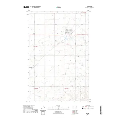
2020 Map of Ray
USGS Topo · Published 2020About this map
Ray serves as the primary hub for this portion of Williams County, organized around a structured grid of streets such as Main St and Score St. The surrounding landscape is defined by the rural section lines of the Public Land Survey System, which dictate the placement of local roads like 64th St NW and 118th Ave NW. For genealogists, the area provides a concentration of distinct burial sites, ranging from the Soine Family Cemetery to those associated with local congregations like Dunkard Church Cemetery and Saint Michaels Cemetery. To the southwest, the smaller settlement of Wheelock sits near the winding course of Beaver Creek, while the Y-Rock Airport indicates the continued importance of aviation in this remote prairie landscape. The interplay of these small communities with the expansive agricultural sections reflects the enduring township structure established in the late 19th and early 20th centuries.
Find a feature on this map
51 named features on this map. Tap any name to fly to it.
Don’t see what you’re looking for? This feature index may not catch every label — zoom into the map to look around manually.
Map Details
Editions of this 2020 Ray Map
This is the sole edition of this map. No revisions or reprints were ever made.
Other maps of this area

1911 · Ray
USGS Topo · 1:125,000

1953 · Williston
USGS Topo · 1:250,000

1957 · Williston
USGS Topo · 1:250,000

1969 · Cussicks Spring
USGS Topo · 1:24,000

1969 · Red Mike Hill
USGS Topo · 1:24,000

1978 · Ray
USGS Topo · 1:24,000

1978 · Ray SE
USGS Topo · 1:24,000

1978 · Temple
USGS Topo · 1:24,000

1978 · Ray NW
USGS Topo · 1:24,000
1978 · Epping NE
USGS Topo · 1:24,000