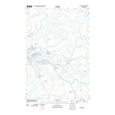
2011 Map of Raymond
USGS Topo · Published 2011About this map
The Willapa River and its southern fork converge at Raymond, a hub of timber and tidewater history on the Washington coast. This 2011 survey illustrates a landscape defined by its waterways and civil infrastructure, from the South Fork Willapa River Bridge to several key impoundments including the Butte Creek Reservoir and Raymond Heights Reservoir. The surrounding valley shows a pattern of early settlements and logging sites, with names like Willapa Valley, Willapa, and Camp One marking the transition from town to timberland. Local history is anchored by the Washington Cemetery to the north and Fern Hill Cemetery to the south, while recreational spaces like the Willapa Harbor Golf Course indicate the community's modern development alongside the winding riverbanks of Ellsworth Creek and Beaver Creek.
Find a feature on this map
65 named features on this map. Tap any name to fly to it.
Don’t see what you’re looking for? This feature index may not catch every label — zoom into the map to look around manually.
Map Details
Editions of this 2011 Raymond Map
This is the sole edition of this map. No revisions or reprints were ever made.
Other maps of this area

1938 · South Bend
USGS Topo · 1:62,500

1940 · Montesano
USGS Topo · 1:62,500

1940 · South Bend
USGS Topo · 1:62,500

1953 · Hoquiam
USGS Topo · 1:250,000

1955 · Montesano
USGS Topo · 1:62,500

1955 · Raymond
USGS Topo · 1:62,500
1955 · North Nemah
USGS Topo · 1:24,000

1955 · Aberdeen SE
USGS Topo · 1:24,000

1957 · Hoquiam
USGS Topo · 1:250,000
1957 · South Bend
USGS Topo · 1:24,000