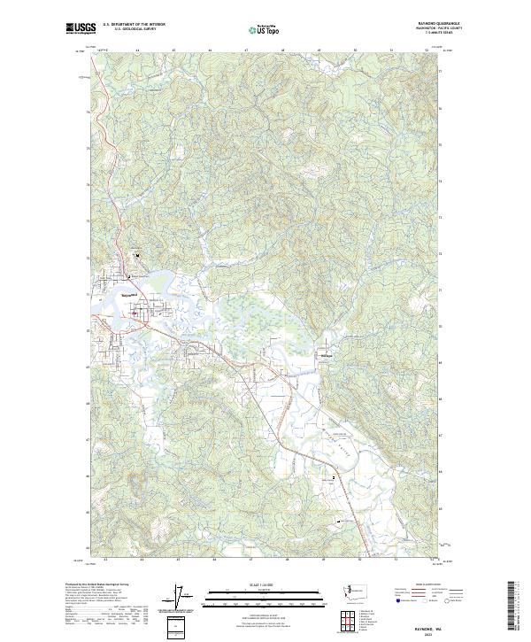
2023 Map of Raymond
USGS Topo · Published 2023About this map
Raymond sits at the confluence of the Willapa River and the South Fork Willapa River, serving as a central hub for the surrounding timber and coastal lowlands. This modern survey illustrates the dense network of logging roads and land management tracts, such as the Farm Service Agency Interest of Washington, that define the upland interior. Local history and genealogy are anchored by several notable burial sites including Washington Cem, Riddell Street Cem, and the Giesy Family Cem.
Find a feature on this map
96 named features on this map. Tap any name to fly to it.
Don’t see what you’re looking for? This feature index may not catch every label — zoom into the map to look around manually.
Map Details
Editions of this 2023 Raymond Map
This is the sole edition of this map. No revisions or reprints were ever made.
Other maps of this area

1938 · South Bend
USGS Topo · 1:62,500

1940 · Montesano
USGS Topo · 1:62,500

1940 · South Bend
USGS Topo · 1:62,500

1953 · Hoquiam
USGS Topo · 1:250,000

1955 · Montesano
USGS Topo · 1:62,500

1955 · Raymond
USGS Topo · 1:62,500
1955 · North Nemah
USGS Topo · 1:24,000

1955 · Aberdeen SE
USGS Topo · 1:24,000

1957 · Hoquiam
USGS Topo · 1:250,000
1957 · South Bend
USGS Topo · 1:24,000