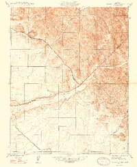
1947 Map of Raynor Creek
USGS Topo · Published 1947About this map
The Chowchilla River winds through this Central California landscape, marking the intersection of three counties as they appeared just after the war. This mid-century survey captures a rural terrain defined by its complex drainage network, where Deadman Creek, Dutch Creek, and Raynor Creek feed into the broader valley floor. The map highlights the shifting boundaries between Mariposa, Merced, and Madera counties, providing a clear record of the political geography of the time.
Find a feature on this map
15 named features on this map. Tap any name to fly to it.
Don’t see what you’re looking for? This feature index may not catch every label — zoom into the map to look around manually.
Map Details
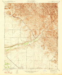
Editions of this 1947 Raynor Creek Map
2 editions found
Other maps of this area

1912 · Mariposa
USGS Topo · 1:125,000

1915 · Owens Creek
USGS Topo · 1:31,680

1916 · Berenda
USGS Topo · 1:31,680

1918 · Owens Creek
USGS Topo · 1:31,680

1918 · Berenda
USGS Topo · 1:31,680

1918 · La Grand
USGS Topo · 1:31,680

1919 · Indian Gulch
USGS Topo · 1:48,000

1919 · Raynor Creek
USGS Topo · 1:31,680

1920 · Indian Gulch
USGS Topo · 1:62,500

1920 · Kismet
USGS Topo · 1:31,680