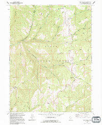
1994 Map of Rays Valley
USGS Topo · Published 1994About this map
The Uinta National Forest dominates this mountain landscape, defined by the systematic drainage of Diamond Fork and its numbered tributaries. This 1994 edition reveals a high-altitude wilderness used for utility and transport, featuring a network of Pack Trails, ATV Trails, and a Tunnel (under construction) near the northern boundary. Settlement is largely absent, replaced by specialized landmarks such as a Radio Facility on Teat Mountain and various Corrals indicating seasonal livestock use.
Find a feature on this map
42 named features on this map. Tap any name to fly to it.
Don’t see what you’re looking for? This feature index may not catch every label — zoom into the map to look around manually.
Map Details
Editions of this 1994 Rays Valley Map
This is the sole edition of this map. No revisions or reprints were ever made.
Other maps of this area

1885 · Salt Lake
USGS Topo · 1:250,000

1885 · Manti
USGS Topo · 1:250,000

1895 · Manti
USGS Topo · 1:250,000

1907 · Strawberry Valley
USGS Topo · 1:125,000

1909 · Strawberry Valley
USGS Topo · 1:125,000

1939 · Soldier Summit
USGS Topo · 1:62,500

1942 · Soldier Summit
USGS Topo · 1:62,500

1954 · Salt Lake City
USGS Topo · 1:250,000

1956 · Price
USGS Topo · 1:250,000

1958 · Salt Lake City
USGS Topo · 1:250,000