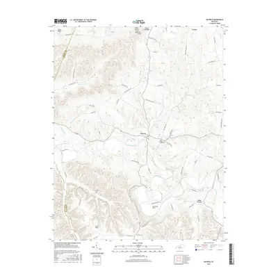
2016 Map of Raywick
USGS Topo · Published 2016About this map
Raywick sits at the heart of this central Kentucky landscape, positioned where Prather Cr and Cherry Run meet the wide valley of the Rolling Fork river. The settlement pattern reveals a deeply rooted rural community, with Catholic heritage visible at Saint Francis and the Saint Francis Xavier Cem. The terrain is defined by dramatic elevation changes, rising from the river bottom to prominent heights like Cedar Knob, Flag Knob, and the extensive Scotts Ridge to the south. Numerous family-named roads, such as Clell Mattingly Rd and Ben Daugherty Rd, suggest generations of local land ownership. To the east, the community of Loretto marks the edge of the survey, while the western reaches follow the winding path of the Rolling Fork through the distinctive loop at Horseshoe Bend.
Find a feature on this map
64 named features on this map. Tap any name to fly to it.
Don’t see what you’re looking for? This feature index may not catch every label — zoom into the map to look around manually.
Map Details
Editions of this 2016 Raywick Map
This is the sole edition of this map. No revisions or reprints were ever made.
Other maps of this area

1953 · Howardstown
USGS Topo · 1:24,000

1953 · Loretto
USGS Topo · 1:24,000

1953 · Saloma
USGS Topo · 1:24,000

1953 · Hibernia
USGS Topo · 1:24,000

1953 · Saint Catharine
USGS Topo · 1:24,000

1953 · New Haven
USGS Topo · 1:24,000

1953 · Raywick
USGS Topo · 1:24,000

1953 · Spurlington
USGS Topo · 1:24,000

1953 · Lebanon West
USGS Topo · 1:24,000

1957 · Winchester
USGS Topo · 1:250,000