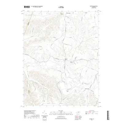
2019 Map of Raywick
USGS Topo · Published 2019About this map
Raywick and the winding course of the Rolling Fork river anchor this Central Kentucky landscape, where the terrain transitions from high ridges like Scotts Ridge to fertile creek bottoms. The area is defined by its deep Catholic heritage, evidenced by settlements such as Saint Francis and Saint Joseph, along with the Saint Francis Xavier Cem. Further north, Loretto sits near the edge of a dissected plateau marked by distinctive peaks like Flag Knob and Bald Knob.
Find a feature on this map
68 named features on this map. Tap any name to fly to it.
Don’t see what you’re looking for? This feature index may not catch every label — zoom into the map to look around manually.
Map Details
Editions of this 2019 Raywick Map
This is the sole edition of this map. No revisions or reprints were ever made.
Other maps of this area

1953 · Howardstown
USGS Topo · 1:24,000

1953 · Loretto
USGS Topo · 1:24,000

1953 · Saloma
USGS Topo · 1:24,000

1953 · Hibernia
USGS Topo · 1:24,000

1953 · Saint Catharine
USGS Topo · 1:24,000

1953 · New Haven
USGS Topo · 1:24,000

1953 · Raywick
USGS Topo · 1:24,000

1953 · Spurlington
USGS Topo · 1:24,000

1953 · Lebanon West
USGS Topo · 1:24,000

1957 · Winchester
USGS Topo · 1:250,000