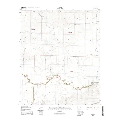
2014 Map of Reader
USGS Topo · Published 2014About this map
The Little Missouri River meanders through this portion of Arkansas, defining the borders between Clark, Nevada, and Ouachita counties. The river valley is a complex network of wetlands and oxbows, including Horseshoe Bend, Bolin Slough, and Minnie Slough. This landscape was historically critical for regional movement, evidenced by the Riffe Ford crossing and the proximity of small rail-side settlements like Whelen Springs, Sayre, and Reader at the southern edge of the quadrangle.
Find a feature on this map
73 named features on this map. Tap any name to fly to it.
Don’t see what you’re looking for? This feature index may not catch every label — zoom into the map to look around manually.
Map Details
Editions of this 2014 Reader Map
This is the sole edition of this map. No revisions or reprints were ever made.
Other maps of this area

1901 · Gurdon
USGS Topo · 1:125,000

1903 · Camden
USGS Topo · 1:125,000

1953 · El Dorado
USGS Topo · 1:250,000

1957 · El Dorado
USGS Topo · 1:250,000

1958 · El Dorado
USGS Topo · 1:250,000

1960 · El Dorado
USGS Topo · 1:250,000

1970 · Whelen Springs
USGS Topo · 1:24,000

1970 · Reader
USGS Topo · 1:24,000
1970 · Gurdon
USGS Topo · 1:24,000
1970 · Curtis
USGS Topo · 1:24,000