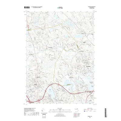
2018 Map of Reading
USGS Topo · Published 2018About this map
The Ipswich River and its accompanying Ipswich River Reservoir define the central geography of this 2018 survey, as the watercourse winds through a suburban landscape of established neighborhoods and expansive wetlands like Cedar Swamp. This modern snapshot of the northern suburbs shows the dense intersection of North Shore communities, where the administrative borders of Essex and Middlesex counties meet. The map reveals a high concentration of memorial grounds, ranging from the historic Old Cem and Park Street Cem to the sprawling Puritan Lawn Memorial Park Cem and Crematory. Residential developments such as Brigadoon Village and Reading Highlands contrast with large water bodies like Lake Quannapowitt and Middleton Pond. Transport corridors including the Newburyport Turnpike and Broadway facilitate movement between the towns, while natural elevations like Huckleberry Hill and Wills Hill punctuate the developed reaches of Lynnfield, Wakefield, and Reading.
Find a feature on this map
78 named features on this map. Tap any name to fly to it.
Don’t see what you’re looking for? This feature index may not catch every label — zoom into the map to look around manually.
Map Details
Editions of this 2018 Reading Map
This is the sole edition of this map. No revisions or reprints were ever made.
Other maps of this area

1886 · Lawrence
USGS Topo · 1:62,500

1888 · Lawrence
USGS Topo · 1:62,500

1888 · Salem
USGS Topo · 1:62,500

1892 · Boston Bay
USGS Topo · 1:62,500

1893 · Salem
USGS Topo · 1:62,500

1893 · Boston
USGS Topo · 1:62,500

1893 · Lawrence
USGS Topo · 1:62,500

1903 · Boston
USGS Topo · 1:62,500

1903 · Boston Bay
USGS Topo · 1:62,500

1917 · Salem
USGS Topo · 1:62,500