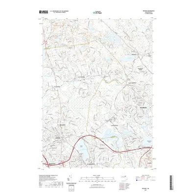
2021 Map of Reading
USGS Topo · Published 2021About this map
Lake Quannapowitt and the Saugus River define the southern landscape of this corridor between Wakefield and Reading. This modern survey highlights the complex suburban infrastructure north of Boston, where industrial heritage paths like the Essex Railroad Rail Trl now intersect with modern residential developments such as Brigadoon Village. The area is densely marked with significant genealogical sites, from the Old Burying Ground Cem in Lynnfield to the Forest Glade Cem near Montrose, reflecting centuries of local history.
Find a feature on this map
72 named features on this map. Tap any name to fly to it.
Don’t see what you’re looking for? This feature index may not catch every label — zoom into the map to look around manually.
Map Details
Editions of this 2021 Reading Map
This is the sole edition of this map. No revisions or reprints were ever made.
Other maps of this area

1886 · Lawrence
USGS Topo · 1:62,500

1888 · Lawrence
USGS Topo · 1:62,500

1888 · Salem
USGS Topo · 1:62,500

1892 · Boston Bay
USGS Topo · 1:62,500

1893 · Salem
USGS Topo · 1:62,500

1893 · Boston
USGS Topo · 1:62,500

1893 · Lawrence
USGS Topo · 1:62,500

1903 · Boston
USGS Topo · 1:62,500

1903 · Boston Bay
USGS Topo · 1:62,500

1917 · Salem
USGS Topo · 1:62,500