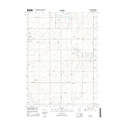
2014 Map of Reading
USGS Topo · Published 2014About this map
Reading and Cambria anchor this portion of Hillsdale County, where the upper reaches of the E Fork W Br Saint Joseph River and the W Fork W Br Saint Joseph River wind through a landscape defined by glacial lakes and managed drainage. The map is particularly rich for genealogical research, documenting numerous small burial sites such as Willits Cem, Dow Cem, and an Amish Cem near the southern boundary. The presence of both the Old Cambria Cem and New Cambria Cem reflects the growth and shift of local populations over time. Water management is a dominant theme of the local geography, evidenced by an extensive system of named channels including Prouty Drain, Joe Drain, and Meade Drain. These waterways connect larger bodies like Bear Lake and the Cambria Millpond, illustrating how the natural hydrology has been adapted for agricultural and local use in south-central Michigan.
Find a feature on this map
65 named features on this map. Tap any name to fly to it.
Don’t see what you’re looking for? This feature index may not catch every label — zoom into the map to look around manually.
Map Details
Editions of this 2014 Reading Map
This is the sole edition of this map. No revisions or reprints were ever made.
Other maps of this area

1914 · Pioneer
USGS Topo · 1:62,500

1939 · Clear Lake
USGS Topo · 1:24,000

1940 · Clear Lake
USGS Topo · 1:24,000

1944 · Pioneer
USGS Topo · 1:62,500

1953 · Fort Wayne
USGS Topo · 1:250,000

1956 · Fort Wayne
USGS Topo · 1:250,000

1959 · Hillsdale
USGS Topo · 1:24,000

1959 · Reading
USGS Topo · 1:24,000

1959 · North Adams
USGS Topo · 1:24,000

1959 · Frontier
USGS Topo · 1:24,000