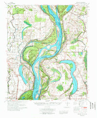
1972 Map of Readland
USGS Topo · Published 1972About this map
Meandering oxbow lakes and complex river cutoffs define this riverine landscape along the border of Arkansas and Mississippi. Centered on the Mississippi River, the map captures a highly engineered alluvial plain where massive water bodies like Lake Washington, Lake Lee, and Grand Lake mark the former paths of the river. The importance of flood control and navigation is evident in features like the Worthington Cut Off (1933) and the earlier American Cutoff (1858), which bypassed the dramatic loops of Worthington Point.
Find a feature on this map
74 named features on this map. Tap any name to fly to it.
Don’t see what you’re looking for? This feature index may not catch every label — zoom into the map to look around manually.
Map Details
Editions of this 1972 Readland Map
This is the sole edition of this map. No revisions or reprints were ever made.
Other maps of this area

1909 · Wilsons Point
USGS Topo · 1:24,000

1909 · Millikin
USGS Topo · 1:24,000

1909 · Ashton Bridge
USGS Topo · 1:24,000

1912 · Ashton Bridge
USGS Topo · 1:31,680

1913 · Wilson Point
USGS Topo · 1:31,680

1935 · Oak Grove
USGS Topo · 1:62,500

1936 · Eudora
USGS Topo · 1:62,500

1936 · Lake Village
USGS Topo · 1:62,500

1939 · Lorenzen
USGS Topo · 1:62,500

1939 · Readland
USGS Topo · 1:62,500