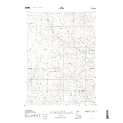
2018 Map of Readstown
USGS Topo · Published 2018About this map
Readstown and Soldiers Grove sit along the winding Kickapoo River, which carves a deep path through the driftless terrain of southern Vernon Co and northern Crawford Co. This 2018 survey reveals a landscape defined by sharp elevation shifts between high ridges like Flannagan Ridge and low-lying valleys such as Spring Valley and Black Bottom. The rural character of the region is punctuated by small settlements like Folsom and several small burial grounds that speak to the area's pioneer history, including Hooverson Cem and Kickapoo Cem. Steep bluffs and local landmarks like Eagle Rock overlook the river valley, while numerous small waterways including Reads Cr and Sherry Cr feed into the main river channel, illustrating the complex drainage patterns of this unglaciated portion of Wisconsin.
Find a feature on this map
99 named features on this map. Tap any name to fly to it.
Don’t see what you’re looking for? This feature index may not catch every label — zoom into the map to look around manually.
Map Details
Editions of this 2018 Readstown Map
This is the sole edition of this map. No revisions or reprints were ever made.
Other maps of this area

1923 · Viroqua
USGS Topo · 1:62,500

1924 · Gays Mills
USGS Topo · 1:62,500

1926 · Gays Mills
USGS Topo · 1:62,500

1926 · Viroqua
USGS Topo · 1:62,500

1926 · La Farge
USGS Topo · 1:62,500

1933 · Boaz
USGS Topo · 1:62,500

1958 · La Crosse
USGS Topo · 1:250,000

1961 · La Crosse
USGS Topo · 1:250,000

1965 · La Crosse
USGS Topo · 1:250,000

1965 · La Farge
USGS Topo · 1:62,500