
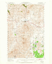
1953 Map of Reardan
USGS Topo · Published 1954About this map
Reardan serves as a central hub on this mid-century survey, situated at the intersection of the Sunset Highway and the Great Northern railroad. The landscape is defined by its agricultural character and rolling coulees, with numerous social halls like Spring Creek Grange and Waukon Grange anchoring the rural community. The map details the transition of local infrastructure, noting several decommissioned sites such as District School No 1 and Moraine Sch.
Find a feature on this map
29 named features on this map. Tap any name to fly to it.
Don’t see what you’re looking for? This feature index may not catch every label — zoom into the map to look around manually.
Map Details
Editions of this 1953 Reardan Map
2 editions found
Other maps of this area

1943 · Medical Lake
USGS Topo · 1:62,500

1944 · Clayton
USGS Topo · 1:62,500

1944 · Wellpinit
USGS Topo · 1:62,500

1945 · Reardan
USGS Topo · 1:62,500

1948 · Turtle Lake
USGS Topo · 1:62,500

1950 · Turtle Lake
USGS Topo · 1:62,500

1950 · Clayton
USGS Topo · 1:62,500

1953 · Wellpinit
USGS Topo · 1:62,500

1953 · Ritzville
USGS Topo · 1:250,000

1954 · Medical Lake
USGS Topo · 1:24,000