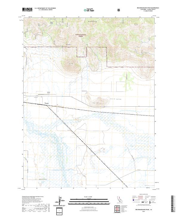
2021 Map of Reconnaissance Peak
USGS Topo · Published 2021About this map
Plumas National Forest dominates the northern reaches of this map, where the high terrain of the Diamond Mountains drops into the expansive Sierra Valley. Peaks and geological formations such as Reconnaissance Peak, Table Rock, and the distinctive Sugar Loaf overlook a complex network of drainage channels including the N Channel Little Last Chance Cr. The transition from the timbered heights of Dotta Canyon to the floor of the Sierra Valley illustrates the shift from industrial forest lands to the agricultural and open-space character of this region of Plumas County.
Find a feature on this map
28 named features on this map. Tap any name to fly to it.
Don’t see what you’re looking for? This feature index may not catch every label — zoom into the map to look around manually.
Map Details
Editions of this 2021 Reconnaissance Peak Map
This is the sole edition of this map. No revisions or reprints were ever made.
Other maps of this area

1890 · Sierraville
USGS Topo · 1:125,000

1892 · Sierraville
USGS Topo · 1:125,000

1894 · Sierraville
USGS Topo · 1:125,000

1950 · Chilcoot
USGS Topo · 1:62,500

1950 · Portola
USGS Topo · 1:62,500

1955 · Loyalton
USGS Topo · 1:62,500

1955 · Sierraville
USGS Topo · 1:62,500

1958 · Chico
USGS Topo · 1:250,000

1960 · Chico
USGS Topo · 1:250,000
1972 · Crocker Mtn
USGS Topo · 1:24,000