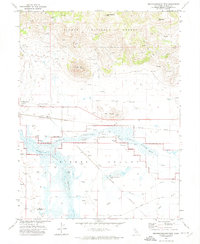
1972 Map of Reconnaissance Peak
USGS Topo · Published 1974About this map
The Middle Fork Feather River meanders through the broad floor of Sierra Valley Channels, a hydrologically complex landscape defined by the confluence of Last Chance Creek and Little Last Chance Creek. This 1972 survey captures a rural landscape where the Western Pacific railroad serves the small settlements of Beckwourth and Hawley. The contrast between the flat valley floor and the surrounding high country is sharp, with the Plumas National Forest rising to prominent heights at Reconnaissance Peak and the distinctive formation of The Buttes.
Find a feature on this map
33 named features on this map. Tap any name to fly to it.
Don’t see what you’re looking for? This feature index may not catch every label — zoom into the map to look around manually.
Map Details
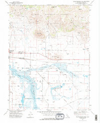
Editions of this 1972 Reconnaissance Peak Map
2 editions found
Other maps of this area

1890 · Sierraville
USGS Topo · 1:125,000

1892 · Sierraville
USGS Topo · 1:125,000

1894 · Sierraville
USGS Topo · 1:125,000

1950 · Chilcoot
USGS Topo · 1:62,500

1950 · Portola
USGS Topo · 1:62,500

1955 · Loyalton
USGS Topo · 1:62,500

1955 · Sierraville
USGS Topo · 1:62,500

1958 · Chico
USGS Topo · 1:250,000

1960 · Chico
USGS Topo · 1:250,000
1972 · Crocker Mtn
USGS Topo · 1:24,000