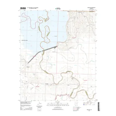
2014 Map of Red Bluff
USGS Topo · Published 2014About this map
Saratoga and the surrounding river bottomlands are defined by the intricate path of the Little River as it weaves along the border between Little River and Hempstead counties. In this modern survey, the landscape reveals a transition from the elevated ridges of Devils Backbone and Shepherd Bluff down to the low-lying wetlands of Cypress Bayou and Bee Bayou. The settlement of Red Bluff and nearby Orton sit south of the river's meandering curves, including prominent features like Baker Bend and Ground Bend. Genealogists will find several rural burial grounds noted, including Saratoga Cem, Hominy Cem, Dowden Cem, and Hill Cem. To the northwest, Millwood Lake and the recreational access point at Yarborough Landing highlight the importance of water management and local recreation in this southwestern Arkansas region.
Find a feature on this map
56 named features on this map. Tap any name to fly to it.
Don’t see what you’re looking for? This feature index may not catch every label — zoom into the map to look around manually.
Map Details
Editions of this 2014 Red Bluff Map
This is the sole edition of this map. No revisions or reprints were ever made.
Other maps of this area

1950 · Ashdown East
USGS Topo · 1:24,000

1950 · Ogden
USGS Topo · 1:24,000

1950 · Red Bluff
USGS Topo · 1:24,000

1950 · Ben Lomond
USGS Topo · 1:24,000

1951 · Ben Lomond
USGS Topo · 1:24,000

1951 · Ogden
USGS Topo · 1:24,000

1951 · Red Bluff
USGS Topo · 1:24,000

1951 · Ashdown East
USGS Topo · 1:24,000

1951 · Homan
USGS Topo · 1:24,000

1951 · Mineral Springs South
USGS Topo · 1:24,000