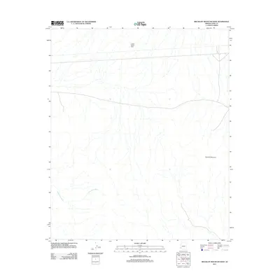
2011 Map of Red Bluff Mountain West
USGS Topo · Published 2011About this map
Red Bluff Mountain and the wide expanses of the Castle Dome Plain define this arid portion of Yuma County, Arizona, as it appeared in the early 21st century. The landscape is characterized by complex drainage patterns, most notably the seasonal runoff channels of Vinegarroon Wash, which weave through the alluvial terrain. This survey provides a precise look at the sparse desert infrastructure of the era, focusing on the remote mountain foothills and the expansive flats where water management and terrain navigation remain the primary geographic features.
Find a feature on this map
3 named features on this map. Tap any name to fly to it.
Don’t see what you’re looking for? This feature index may not catch every label — zoom into the map to look around manually.
Map Details
Editions of this 2011 Red Bluff Mountain West Map
This is the sole edition of this map. No revisions or reprints were ever made.
Other maps of this area

1926 · Fortuna
USGS Topo · 1:62,500

1926 · Wellton
USGS Topo · 1:62,500

1929 · Fortuna
USGS Topo · 1:62,500

1929 · Laguna
USGS Topo · 1:62,500

1929 · Wellton
USGS Topo · 1:62,500

1942 · Yuma
USGS Topo · 1:250,000

1943 · Laguna
USGS Topo · 1:62,500

1954 · El Centro
USGS Topo · 1:250,000

1955 · El Centro
USGS Topo · 1:250,000
1955 · Dome
USGS Topo · 1:24,000