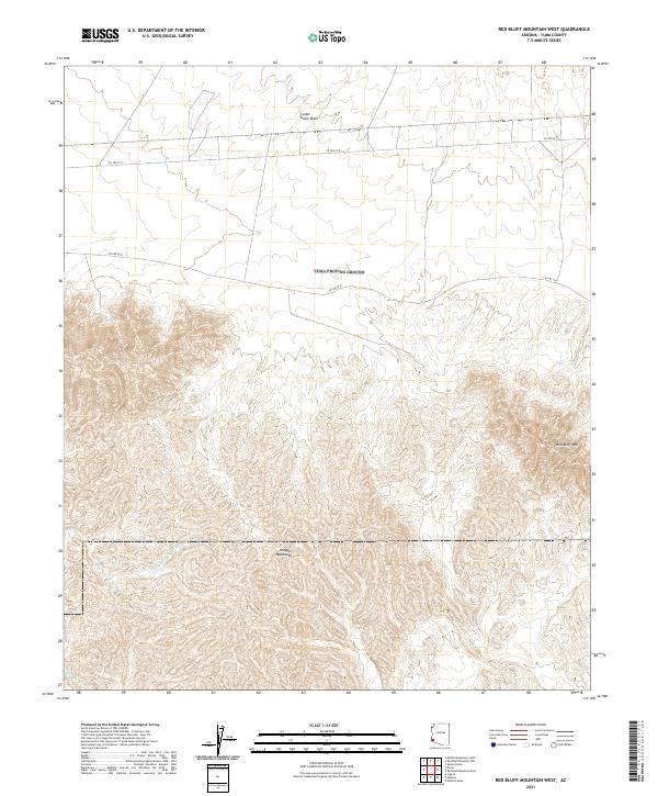
2021 Map of Red Bluff Mountain West
USGS Topo · Published 2021About this map
Castle Dome Plain dominates the northern reaches of this Yuma County landscape, giving way to the complex, high-relief topography of the Muggins Mountains in the south. This modern survey illustrates the drainage patterns typical of the arid Southwest, where intermittent watercourses like Vinegaroon Wash and Morgan Wash carve paths through the desert floor. The eastern portion of the sheet is marked by the prominent elevation of Red Bluff Mtn, a significant landmark in this sparsely settled region. Human activity is represented primarily by a sparse network of county roads, including Co 3rd ST N and Co 2nd ST N, which cut straight lines across the flats before the terrain becomes increasingly inaccessible to the south. The map provides a clear look at the Public Land Survey System grid, including the intersection of multiple township and range lines.
Find a feature on this map
13 named features on this map. Tap any name to fly to it.
Don’t see what you’re looking for? This feature index may not catch every label — zoom into the map to look around manually.
Map Details
Editions of this 2021 Red Bluff Mountain West Map
This is the sole edition of this map. No revisions or reprints were ever made.
Other maps of this area

1926 · Fortuna
USGS Topo · 1:62,500

1926 · Wellton
USGS Topo · 1:62,500

1929 · Fortuna
USGS Topo · 1:62,500

1929 · Laguna
USGS Topo · 1:62,500

1929 · Wellton
USGS Topo · 1:62,500

1942 · Yuma
USGS Topo · 1:250,000

1943 · Laguna
USGS Topo · 1:62,500

1954 · El Centro
USGS Topo · 1:250,000

1955 · El Centro
USGS Topo · 1:250,000
1955 · Dome
USGS Topo · 1:24,000