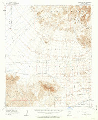
1955 Map of Red Bluff Mtn
USGS Topo · Published 1963About this map
Kofa Game Range dominates the northern reaches of this mid-century survey, where the jagged peaks of the Castle Dome Mts rise above the arid Dome Plain. This landscape reflects a period of intense federal land management and military activity, with the Yuma Test Station occupying a significant portion of the central desert floor. Grounded in the harsh geography of southwestern Arizona, the map reveals a network of Jeep Trails and isolated water sources like Dixon Spr and Salton Tanks that were vital for transit through the mountain passes. To the south, the terrain transitions into the Mohawk Valley, defined by the Mohawk Canal and the southern slopes of Red Bluff Mountain. Notable mining artifacts, including several Shafts and a Tunnel near Thumb Butte, point to the area's prospecting history, while numerous Observation Towers underscore the region's mid-century tactical importance.
Find a feature on this map
43 named features on this map. Tap any name to fly to it.
Don’t see what you’re looking for? This feature index may not catch every label — zoom into the map to look around manually.
Map Details
Editions of this 1955 Red Bluff Mtn Map
3 editions found
Other maps of this area

1926 · Fortuna
USGS Topo · 1:62,500

1926 · Wellton
USGS Topo · 1:62,500

1926 · Mohawk
USGS Topo · 1:62,500

1928 · Mohawk
USGS Topo · 1:62,500

1928 · Norton
USGS Topo · 1:62,500

1929 · Fortuna
USGS Topo · 1:62,500

1929 · Laguna
USGS Topo · 1:62,500

1929 · Wellton
USGS Topo · 1:62,500

1929 · Norton
USGS Topo · 1:62,500

1939 · Red Hill
USGS Topo · 1:62,500