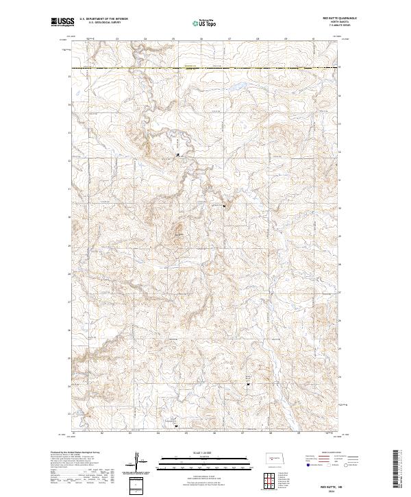
2024 Map of Red Butte
USGS Topo · Published 2024About this map
Red Butte stands as a prominent landmark in this prairie landscape along the Mercer and Oliver county line. The terrain is defined by the drainages of Brady Creek to the north and Otter Creek to the southwest, which carve through the high plains of North Dakota. For genealogists and local historians, the area is notable for its cluster of rural burial grounds that speak to the region's early settlement patterns. Locations such as the Schmall Congregational Cem, Nisbet Cem, and Red Butte Cem are positioned near the intersection of section-line roads like 50th Ave SW and 15th St SW. The presence of the Spring Brook Cem further south reflects the dispersed nature of this agricultural community, where small family and church-affiliated cemeteries remain the primary markers of historical residence.
Find a feature on this map
33 named features on this map. Tap any name to fly to it.
Don’t see what you’re looking for? This feature index may not catch every label — zoom into the map to look around manually.
Map Details
Editions of this 2024 Red Butte Map
This is the sole edition of this map. No revisions or reprints were ever made.
Other maps of this area

1948 · Stanton
USGS Topo · 1:62,500

1949 · Stanton
USGS Topo · 1:62,500

1954 · McClusky
USGS Topo · 1:250,000

1958 · McClusky
USGS Topo · 1:250,000

1968 · Red Butte
USGS Topo · 1:24,000

1968 · Red Butte NW
USGS Topo · 1:24,000

1968 · Hazen West
USGS Topo · 1:24,000

1968 · Stanton
USGS Topo · 1:24,000

1968 · Hannover NW
USGS Topo · 1:24,000

1968 · Hazen East
USGS Topo · 1:24,000