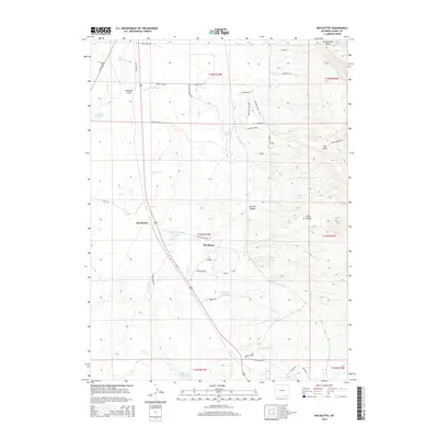
2015 Map of Red Buttes
USGS Topo · Published 2015About this map
The Buttes and the namesake Red Buttes dominate this high-plains landscape in Albany County, where the high desert meets the foothills. This 2015 survey illustrates a rural Wyoming geography defined by its hydrology and livestock-driven ranching infrastructure. Numerous vital water sources are documented, including Simpson Springs, Soldier Spring, and Goforth Reservoir. The drainage patterns of Harney Cr and Simpson Springs Cr carve through distinct terrain features like Gilmore Gulch and Sawmill Canyon, providing a detailed look at the region's physical geography. Local road networks like City Ranch Rd and Sand Creek Rd connect these remote landmarks, offering a modern view of land use and property boundaries in the expansive Wyoming range.
Find a feature on this map
48 named features on this map. Tap any name to fly to it.
Don’t see what you’re looking for? This feature index may not catch every label — zoom into the map to look around manually.
Map Details
Editions of this 2015 Red Buttes Map
This is the sole edition of this map. No revisions or reprints were ever made.
Other maps of this area

1895 · Laramie
USGS Topo · 1:125,000

1902 · Laramie
USGS Topo · 1:125,000

1905 · Sherman
USGS Topo · 1:125,000

1905 · Laramie
USGS Topo · 1:125,000

1906 · Laramie
USGS Topo · 1:125,000

1908 · Laramie
USGS Topo · 1:125,000

1948 · Sherman Mountains
USGS Topo · 1:62,500

1948 · Ragged Top Mountain
USGS Topo · 1:62,500

1950 · Ragged Top Mountain
USGS Topo · 1:62,500

1950 · Sherman Mountains
USGS Topo · 1:62,500