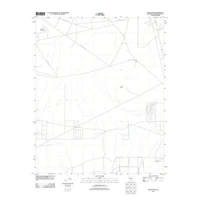
2012 Map of Red Buttes
USGS Topo · Published 2012About this map
Edwards Air Force Sta land dominates the northern half of this San Bernardino County landscape, marking the intersection of military operations and the open high desert. The terrain is punctuated by distinctive volcanic remnants, most notably Haystack Butte in the northwest and the central Red Buttes. This 2012 survey reveals a sparse but deliberate network of transit and local industry, with the Sun Hill Ranch Airport serving as a remote aviation node near the southern boundary.
Find a feature on this map
17 named features on this map. Tap any name to fly to it.
Don’t see what you’re looking for? This feature index may not catch every label — zoom into the map to look around manually.
Map Details
Editions of this 2012 Red Buttes Map
This is the sole edition of this map. No revisions or reprints were ever made.
Other maps of this area

1931 · Adobe
USGS Topo · 1:24,000

1932 · Barstow
USGS Topo · 1:125,000

1934 · Barstow
USGS Topo · 1:125,000

1934 · Adobe
USGS Topo · 1:24,000

1937 · Shadow Mountains
USGS Topo · 1:48,000

1937 · Kramer
USGS Topo · 1:48,000

1942 · Kramer
USGS Topo · 1:62,500

1942 · Shadow Mountains
USGS Topo · 1:62,500

1947 · Kramer
USGS Topo · 1:24,000

1947 · Rich
USGS Topo · 1:24,000