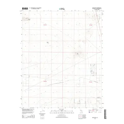
2015 Map of Red Buttes
USGS Topo · Published 2015About this map
Red Buttes and Haystack Butte rise from the high-desert terrain in this portion of the Mojave Desert near the border of Townships 8 and 9 North. The landscape is defined by a rigid grid of unpaved and secondary roads, indicating a pattern of rural land division and scattered desert homesteads like Astley Rancho. To the southeast, the Sun Hill Ranch Airport serves as a remote aviation landmark along Sun Hill Rd. The transportation network is extensive despite the sparse settlement, with named routes such as Buckthorne Canyon Rd and Silver Peak Rd providing access through the arid flats. This survey documents the intersection of vast public land survey sections with modern desert developments, capturing the specific spatial organization of the California interior in the mid-2010s.
Find a feature on this map
26 named features on this map. Tap any name to fly to it.
Don’t see what you’re looking for? This feature index may not catch every label — zoom into the map to look around manually.
Map Details
Editions of this 2015 Red Buttes Map
This is the sole edition of this map. No revisions or reprints were ever made.
Other maps of this area

1931 · Adobe
USGS Topo · 1:24,000

1932 · Barstow
USGS Topo · 1:125,000

1934 · Barstow
USGS Topo · 1:125,000

1934 · Adobe
USGS Topo · 1:24,000

1937 · Shadow Mountains
USGS Topo · 1:48,000

1937 · Kramer
USGS Topo · 1:48,000

1942 · Kramer
USGS Topo · 1:62,500

1942 · Shadow Mountains
USGS Topo · 1:62,500

1947 · Kramer
USGS Topo · 1:24,000

1947 · Rich
USGS Topo · 1:24,000