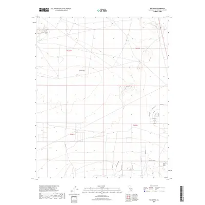
2018 Map of Red Buttes
USGS Topo · Published 2018About this map
Red Buttes and Haystack Butte rise as prominent geological landmarks within the High Desert of San Bernardino County. This 2018 survey documents a remote portion of the Mojave Desert where land use is defined by a sparse network of dirt and gravel roads rather than dense settlements. The southern portion of the map shows a nascent grid of residential streets including Coconino Ave, Navajo St, and Apache Ave, indicating a pattern of rural desert development. Aviation history is represented by the Sun Hill Ranch Airport in the southeastern corner, while the presence of Princess Pat Mine Rd points to the region's long-standing connection to local mineral exploration. The map provides a clear look at the intersection of public lands and private holdings during a period of transition in California's arid interior.
Find a feature on this map
26 named features on this map. Tap any name to fly to it.
Don’t see what you’re looking for? This feature index may not catch every label — zoom into the map to look around manually.
Map Details
Editions of this 2018 Red Buttes Map
This is the sole edition of this map. No revisions or reprints were ever made.
Other maps of this area

1931 · Adobe
USGS Topo · 1:24,000

1932 · Barstow
USGS Topo · 1:125,000

1934 · Barstow
USGS Topo · 1:125,000

1934 · Adobe
USGS Topo · 1:24,000

1937 · Shadow Mountains
USGS Topo · 1:48,000

1937 · Kramer
USGS Topo · 1:48,000

1942 · Kramer
USGS Topo · 1:62,500

1942 · Shadow Mountains
USGS Topo · 1:62,500

1947 · Kramer
USGS Topo · 1:24,000

1947 · Rich
USGS Topo · 1:24,000