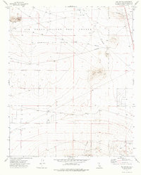
1973 Map of Red Buttes
USGS Topo · Published 1976About this map
Edwards Air Force Base dominates this Mojave Desert landscape, serving as a critical environment for the Air Force Flight Test Center during the early 1970s. The map illustrates the specialized infrastructure required for aerospace development, including a Tracking Station, Observation Tower, and multiple designated targets across the high desert floor.
Find a feature on this map
16 named features on this map. Tap any name to fly to it.
Don’t see what you’re looking for? This feature index may not catch every label — zoom into the map to look around manually.
Map Details
Editions of this 1973 Red Buttes Map
This is the sole edition of this map. No revisions or reprints were ever made.
Other maps of this area

1931 · Adobe
USGS Topo · 1:24,000

1932 · Barstow
USGS Topo · 1:125,000

1934 · Barstow
USGS Topo · 1:125,000

1934 · Adobe
USGS Topo · 1:24,000

1937 · Shadow Mountains
USGS Topo · 1:48,000

1937 · Kramer
USGS Topo · 1:48,000

1942 · Kramer
USGS Topo · 1:62,500

1942 · Shadow Mountains
USGS Topo · 1:62,500

1947 · Kramer
USGS Topo · 1:24,000

1947 · Rich
USGS Topo · 1:24,000