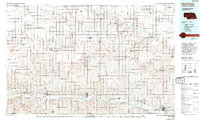
1985 Map of Red Cloud
USGS Topo · Published 1994About this map
The Republican River and Little Blue River valleys define the agricultural and hydraulic character of this South Central Nebraska and North Central Kansas landscape. Following the 1980s revision of earlier surveys, the map illustrates an extensive irrigation network, including the Courtland Canal and the Franklin South Side Pump Canal, which support the region's farming economy. The rail corridor of the Burlington Northern connects river towns such as Red Cloud and Superior, while smaller rail-line junctions like Lester Junction and the Industrial Railroad near Bostwick highlight the logistical infrastructure of the era.
Find a feature on this map
63 named features on this map. Tap any name to fly to it.
Don’t see what you’re looking for? This feature index may not catch every label — zoom into the map to look around manually.
Map Details
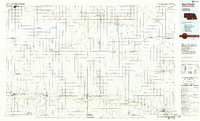
Editions of this 1985 Red Cloud Map
2 editions found
Other maps of this area

1892 · Concordia
USGS Topo · 1:125,000

1893 · Smith Center
USGS Topo · 1:125,000

1893 · Phillipsburg
USGS Topo · 1:125,000

1894 · Mankato
USGS Topo · 1:125,000

1894 · Kenesaw
USGS Topo · 1:62,500

1894 · Kearney
USGS Topo · 1:62,500

1894 · Minden
USGS Topo · 1:62,500

1896 · Holdrege
USGS Topo · 1:125,000

1896 · Kearney
USGS Topo · 1:125,000

1896 · Wood River
USGS Topo · 1:125,000